April 22, 2026

Explore Whitewater's Public GIS Map! 🌐🗺️💡
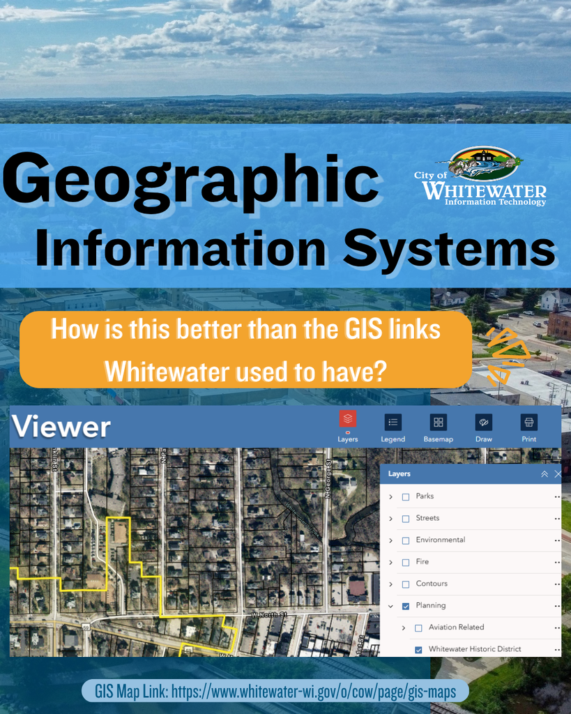
Are you curious to know how our new GIS Viewer is better than the old links on the previous website?
The new GIS Viewer takes all the separate mapping tools our community used to rely on and combines them into one powerful, easy‑to‑use platform. Instead of switching between multiple websites and apps, everything you need is now in a single viewer.
This upgraded system lets you quickly find answers to everyday questions like:
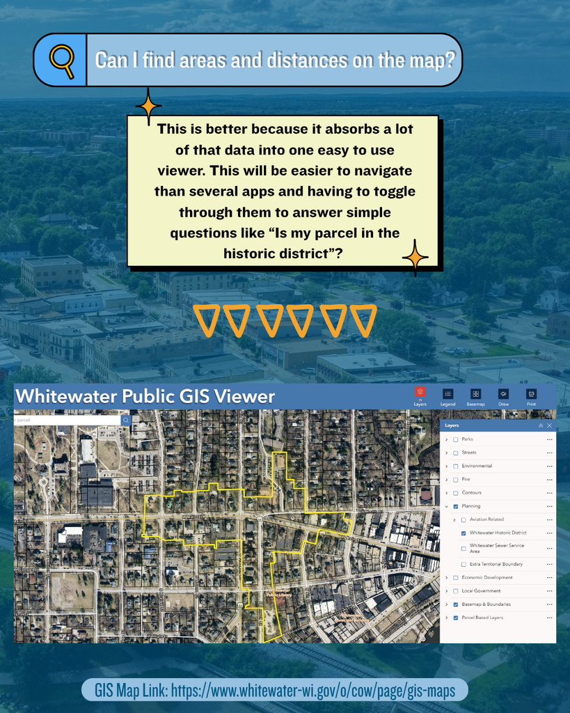
📍 Is my parcel in the historic district?
🌳 What environmental layers apply to my area?
🚧 How is my property zoned?
By absorbing so much information into one place, the new GIS Viewer is faster, clearer, and far easier to navigate. It'll save time for anyone exploring Whitewater’s data. 💡✨
🔗Check out our NEW digital, interactive map on the GIS Map page City of Whitewater's Website.
Are you curious to know how our new GIS Viewer is better than the old links on the previous website?
The new GIS Viewer takes all the separate mapping tools our community used to rely on and combines them into one powerful, easy‑to‑use platform. Instead of switching between multiple websites and apps, everything you need is now in a single viewer.
This upgraded system lets you quickly find answers to everyday questions like:
📍 Is my parcel in the historic district?
🌳 What environmental layers apply to my area?
🚧 How is my property zoned?
By absorbing so much information into one place, the new GIS Viewer is faster, clearer, and far easier to navigate. It'll save time for anyone exploring Whitewater’s data. 💡✨
🔗Check out our NEW digital, interactive map on the GIS Map page City of Whitewater's Website.